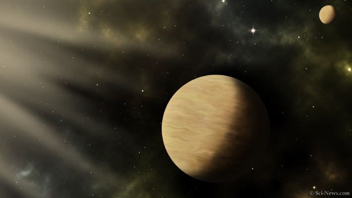
Astronomers have discovered and validated two small exoplanets orbiting the nearby red dwarf star TOI-1266.

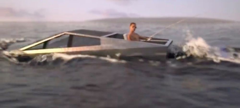
Elon Musk is hinting at Tesla Cybertruck being virtually amphibious, and it’s not clear if he’s actually kidding.
Sometimes, Musk makes comments about future Tesla products and features that can be hard to judge.
For example, it was hard to tell if he was kidding when he said that the next Tesla Roadster would be equipped with a cold air thruster, but that’s apparently happening.

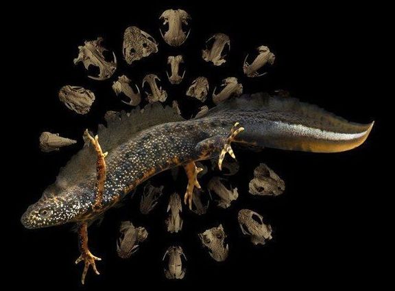
A team of scientists, led by Natural History Museum postdoctoral researcher Dr. Anne-Claire Fabre, have conducted the first study on how metamorphosis has influenced the evolution of salamanders.
Using micro-CT scanning to study the skulls of this group of animals, the team were able to build a huge dataset of 148 species of salamanders and used cutting-edge methods to describe the shape of the skull with nearly 1000 reference points, known as landmarks.
Dr. Fabre said, “Most studies of this kind are limited to just a few dozen landmarks. Our study is the first large-scale investigation of this incredibly diverse group. We have captured the shape of the skull in such great detail that it has allowed us to learn more than ever before about how these creatures evolved.”
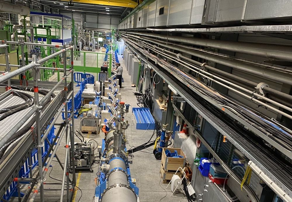
Intensity is rising at CERN. In the superconducting equipment testing hall, an innovative transmission line has set a new record for the transport of electricity. The link, which is 60 metres long, has transported a total of 54 000 amperes (54 kA, or 27 kA in either direction). “It is the most powerful electrical transmission line built and operated to date!” says Amalia Ballarino, the designer and project leader.
The line has been developed for the High-Luminosity LHC (HL-LHC), the accelerator that will succeed the Large Hadron Collider (LHC) and is scheduled to start up at the end of 2027. Links like this one will connect the HL-LHC’s magnets to the power converters that supply them.
The secret to the new line’s power can be summarised in one word: superconductivity.

As always, we welcome reader submissions, and if you don’t want to miss an issue, please subscribe using the box below (the form will not appear on AMP-enabled versions of the site). Each report will include information on small-, medium-, and heavy-lift rockets as well as a quick look ahead at the next three launches on the calendar.
NASA ready to buy suborbital rides for its people. This week, NASA formally asked the US space industry to dish the details on its plans for brief spaceflights. In essence, the space agency said it wants to buy brief hops into space for its Astronaut Corps and scientists, but it needs more information, Ars reports. NASA Administrator Jim Bridenstine said the program seeks mostly to increase the time NASA spends in microgravity.
Balancing cost and risk … The biggest question concerns the risk that NASA is willing to accept in putting its people on these space vehicles. For the space shuttle program, NASA had complete oversight of the vehicle’s development. Although the commercial crew program was a public-private partnership, NASA still had significant insight into every facet of SpaceX’s Crew Dragon and Boeing’s Starliner spacecraft because it paid for most of the development costs. Now, NASA is solely a customer. “We’re not going to make it more dangerous than orbital flight,” Bridenstine said of suborbital flight.
Mars — YES or NOT?
Multi-billionaire founder of SpaceX and Tesla Elon Musk said he believes there is a 70% chance of him getting to Mars on one of his spacecraft. The Independent reports:
Tech entrepreneur Elon Musk has claimed there is a 70 per cent likelihood he will make it to Mars on one of his spacecraft – despite there being “a good chance of death”.
The 47-year-old founder of Tesla, who is among several businessmen seeking to find a way to reach the red planet, said while some consider his vision a fantasy, he thinks making the journey could be possible in as little as seven years from now, with the price of a ticket as low as “a couple of hundred thousand dollars”.
“I know exactly what to do,” Mr Musk told Axios on HBO. “I’m talking about moving there.”

DNA replication is a process of critical importance to the cell, and must be coordinated precisely to ensure that genomic information is duplicated once and only once during each cell cycle. Using super-resolution technology a University of Technology Sydney led team has directly visualized the process of DNA replication in single human cells.
This is the first quantitative characterization to date of the spatio-temporal organization, morphology, and in situ epigenetic signatures of individual replication foci (RFi) in single human cells at the nanoscale.
The results of the study, published in PNAS (Proceedings of the National Academy of Sciences) give new insight into a poorly understood area of DNA replication namely how replication origin sites are chosen from thousands of possible sites.
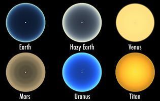
Click on photo to start video.
Have you ever wondered what sunsets on other worlds might look like?
Now you can find out, thanks to simulations created by Goddard scientist Geronimo Villanueva.
When sunlight interacts with molecules in a planet’s or moon’s atmosphere, it creates the kaleidoscope of colors you see in these simulations.
