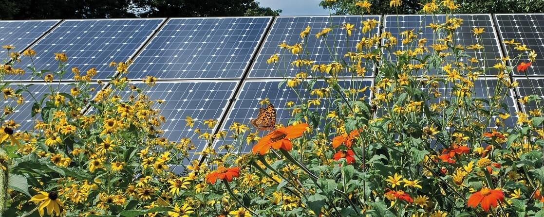
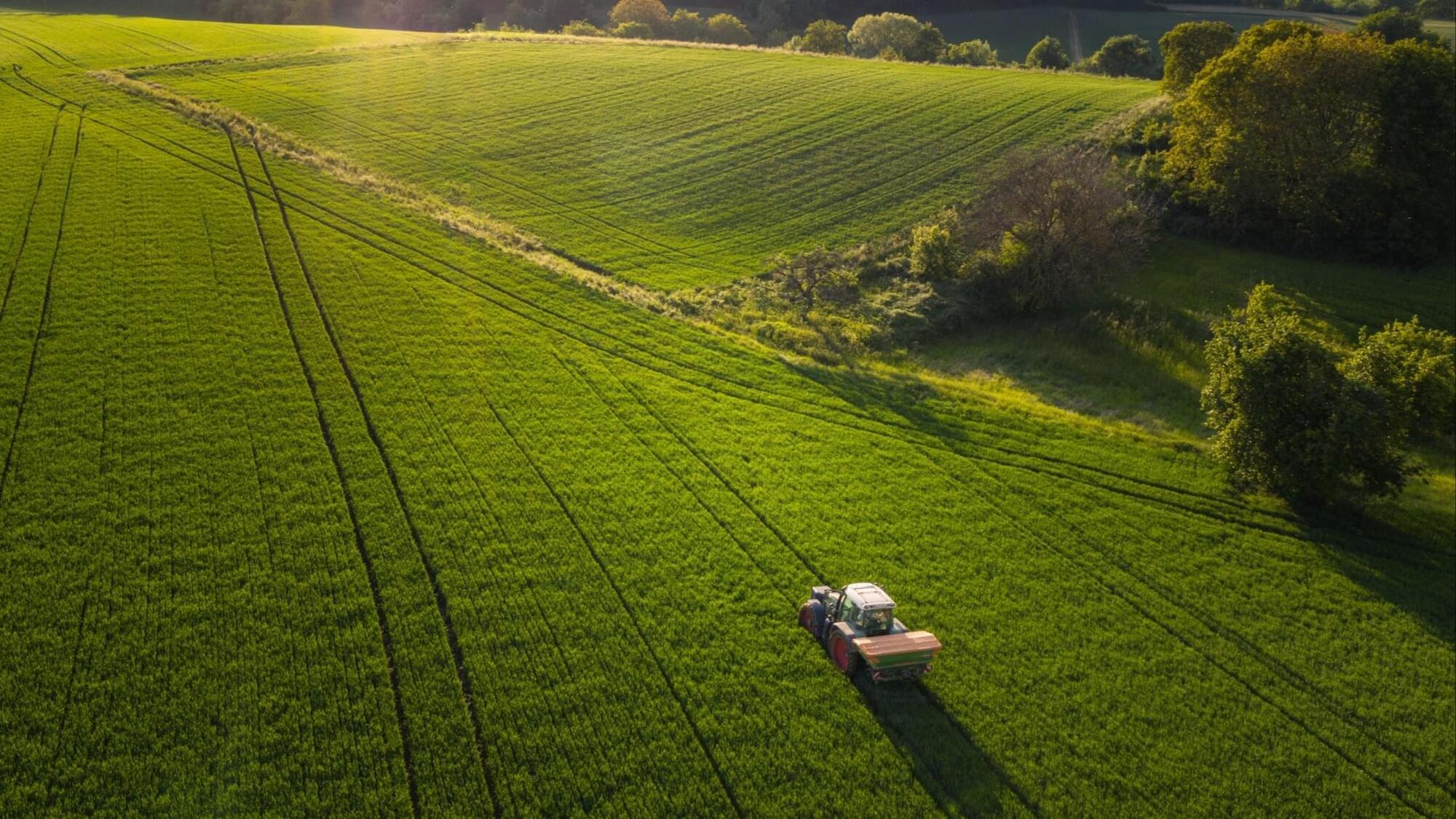
Toggle light / dark theme

Mars Curiosity Rover takes a Last Look at Mysterious Sulfur

NASA’s Curiosity rover is preparing for the next leg of its journey, a months-long trek to a formation called the boxwork, a set of weblike patterns on Mars’s surface that stretches for miles. It will soon leave behind Gediz Vallis channel, an area wrapped in mystery. How the channel formed so late during a transition to a drier climate is one big question for the science team. Another mystery is the field of white sulfur stones the rover discovered over the summer.

Curiosity imaged the stones, along with features from inside the channel, in a 360-degree panorama before driving up to the western edge of the channel at the end of September.

The rover is searching for evidence that ancient Mars had the right ingredients to support microbial life, if any formed billions of years ago, when the Red Planet held lakes and rivers. Located in the foothills of Mount Sharp, a 3-mile-tall (5-kilometer-tall) mountain, Gediz Vallis channel may help tell a related story: what the area was like as water was disappearing on Mars. Although older layers on the mountain had already formed in a dry climate, the channel suggests that water occasionally coursed through the area as the climate was changing.

Digital twin model enables precise simulation of forest landscapes, depicting a forest in 100 years

Forest ecosystems of the future will have to cope with very different conditions to those of today. For this reason, researchers at the Technical University of Munich (TUM) state that a strategic approach to forest management is crucial. To this end, the research team has developed iLand: a simulation model that can compute long-term developments of large forest landscapes, right down to the individual tree—including disturbances from bark beetles to wildfires.

Charred tree trunks and blackened soil are typical of the desolation that a leaves behind. Inevitably, the question arises whether it will be possible to restore a green natural landscape. According to Rupert Seidl, Professor of Ecosystem Dynamics and Forest Management, this is possible, but the “how” decides how much the new forest will benefit the climate, nature and people.

“Today’s forest ecosystems are not particularly well adapted to future climate conditions,” says Seidl. “Over the next decades they will presumably come under increasing pressure from water shortage and insect pests, and may even die off. This is why it makes sense to use measures such as the reforestation of disturbed areas to strategically select tree species and take future developments into consideration.”

Volcanic Eruption in the Philippines Forces Mass Evacuation

The Philippine authorities ordered nearly 90,000 people to evacuate after a volcano on the central island of Negros erupted, spewing a two-mile-high plume of deadly ash, lava and large rocks.

The volcano, Mount Kanlaon, erupted on Monday afternoon, and the authorities warned that it could happen again in the coming days.

“This is very destructive and it can burn everything in its path, including vegetation, buildings and humans,” said Teresito Bacolcol, the head of seismology at the Philippine Institute of Volcanology and Seismology. “This can kill.”

‘Climatopias’: Researchers evaluate effectiveness of climate-inspired urban designs

A pair of new studies by scientists at the University of Miami Rosenstiel School of Marine, Atmospheric, and Earth Science and the School of Architecture, shed new light on the potential of climate-inspired architectural and urban design proposals, termed “climatopias,” to effectively address climate change challenges. These studies analyze both specific high-profile projects and a broader range of proposals, providing valuable frameworks for evaluating their effectiveness, feasibility, and social justice implications.

The first paper focuses on a detailed analysis of four prominent climatopic design projects. Utilizing a novel evaluation approach, the researchers assessed each project on its effectiveness, justice, and feasibility.

Key findings indicate that for climatopias to serve as viable climate solutions, they must prioritize their embodied , feature affordable and participatory designs, and possess the potential for actual implementation or stimulate critical discourse around decarbonization and adaptation strategies, enriching in climate resilience. The findings are published in the journal One Earth.

AI Supercharging Crop Breeding to Protect Farmers from Climate

Avalo, a crop development company based in North Carolina, is using machine learning models to accelerate the creation of new and resilient crop varieties.

The traditional way to select for favorable traits in crops is to identify individual plants that exhibit the trait – such as drought resistance – and use those plants to pollinate others, before planting those seeds in fields to see how they perform. But that process requires growing a plant through its entire life cycle to see the result, which can take many years.

Avalo uses an algorithm to identify the genetic basis of complex traits like drought, or pest resistance in hundreds of crop varieties. Plants are cross-pollinated in the conventional way, but the algorithm can predict the performance of a seed without needing to grow it – speeding up the process by as much as 70%, according to Avalo chief technology officer Mariano Alvarez.

In PICS: 10 Best Earth Images Captured From Space In 2024

Earth In 2024: The International Space Station (ISS) has captured more than 825,000 images of Earth so far in 2024, documenting our planet’s changing landscapes. NASA has shared that over 5.3 million photos have been taken from the space station since it began operations, contributing significantly to studies of urban light patterns, lightning activity, and natural disasters. In 2024 alone, these images were instrumental in analysing 14 major natural disaster events, from hurricanes and floods to volcanic eruptions.

Expedition 71, one of the most prolific missions in the ISS’s history, contributed over 630,000 images, marking the highest number of photographs taken during a single mission.

According to NASA, the Crew Earth Observations (CEO) program is at the heart of this effort. Equipped with digital handheld cameras, astronauts photograph Earth from their vantage point 200 miles above the surface. The program focuses on documenting both human-induced changes — such as urban expansion and reservoir construction — and natural phenomena, including hurricanes and wildfires.

Huge Experiment Gives First Glimpse of The Internal Structure of a Neutron

An experiment more than 10 years in the making has delivered its first glimpse of the hurricane of particles whirring inside subatomic particles called neutrons, laying the groundwork to solve a mystery deep in the heart of matter.

Data from the Central Neutron Detector at the US Department of Energy’s Thomas Jefferson National Accelerator Facility (TJNAF) is already playing a role in describing the quantum map of the neutron’s engine.

“It’s a quite important result for the study of nucleons,” says Silvia Niccolai, a research director at the French National Centre for Scientific Research.