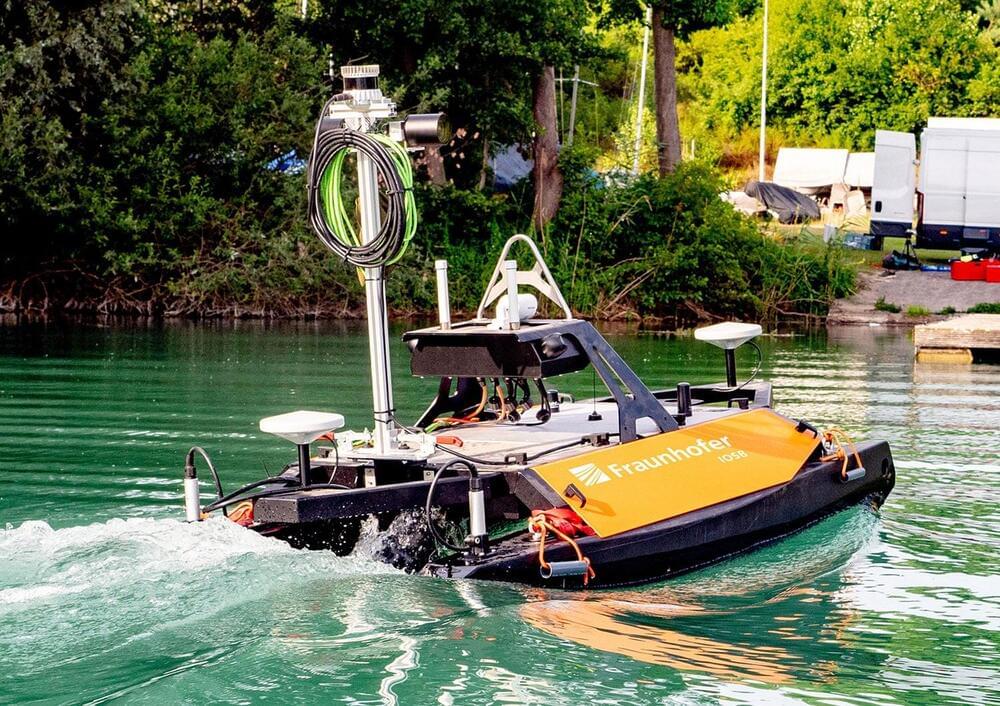
Fraunhofer researchers developed an easy-to-operate, unmanned watercraft that autonomously surveys bodies of water both above and below the surface and produces corresponding 3D maps.
The unmanned watercraft uses its GPS, acceleration and angular rate sensors, and a Doppler velocity log (DVL) sensor to incrementally feel its way along the bottom of the body of water. In combination with mapping software, laser scanners, and cameras enable the device to reconstruct high-precision 3D models of the surroundings above water. A multi-beam sonar integrated into the sensor system is used for underwater mapping and creating a complete 3D model of the bed.
“Our navigation system is semi-automatic in that the user only needs to specify the area to be mapped. The surveying process itself is fully automatic, and data evaluation is carried out with just a few clicks of the mouse. We developed the software modules required for the mapping and autonomous piloting,” explains Dr. Janko Petereit, a scientist at Fraunhofer IOSB.
During the journey, it autonomously avoids obstacles detected by the laser scanner and sonar and generates a 3D model in real time for navigation purposes, including dynamic objects such as moving vessels.