When landing Apollo 11 in 1969, astronauts looked out the window for distinguishing features that they recognized from maps of the Moon and were able to steer the lander to avoid a disastrous touchdown on top of a rocky area. Now, 50 years later, the process can be automated. Distinguishing features, like known craters, boulders, or other unique surface characteristics, provide insight into surface hazards to help avoid them while landing.
NASA scientists and engineers are maturing technology for navigating and landing on planetary bodies by analyzing images during descent – a process called terrain relative navigation (TRN). This optical navigation technology is included on NASA’s newest Mars rover, Perseverance, which will test TRN when it lands on the Red Planet in 2021, paving the way for future crewed missions to the Moon and beyond. TRN was also being used during NASA’s recent Origins, Spectral Interpretation, Resources Identification, Security, Regolith Explorer (OSIRIS-REx) mission Touch-and-Go (TAG) event to collect samples of the asteroid Bennu in order to better understand the characteristics and movement of asteroids.
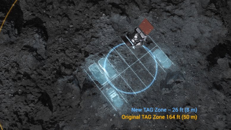
Since reaching Bennu in 2018, the OSIRIS-REx spacecraft has mapped and studied its surface, including its topography and lighting conditions, in preparation for TAG. Nightingale crater was chosen from four candidate sites based on its great amount of sampleable material and accessibility for the spacecraft.